Education
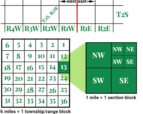
The Public Land Survey System (PLSS) is a way of subdividing and describing land in the United States. All lands in the public domain are subject to subdivision by this rectangular system of surveys, which is regulated by the U.S. Department of the Interior, Bureau of Land Management (BLM).
The PLSS is used to divide public domain lands, which are lands owned by the Federal government for the benefit of the citizens of the United States.
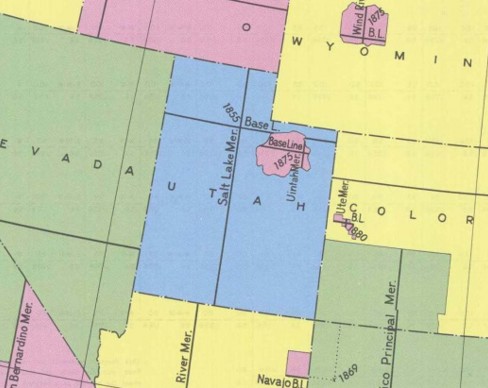
The original public domain included the land ceded to the Federal Government by the thirteen original States, supplemented with acquisitions from native Indians and foreign powers. It encompasses major portions of the land area of 30 southern and western States. Since the original PLSS surveys were completed, much of the land that was originally part of the public domain has been transferred to private ownership and in some areas the PLSS has been extended, following similar rules of division, into non-public domain areas.
For areas that were once part of the public domain, legal land descriptions are usually written in terms of PLSS descriptions. Learn more.


